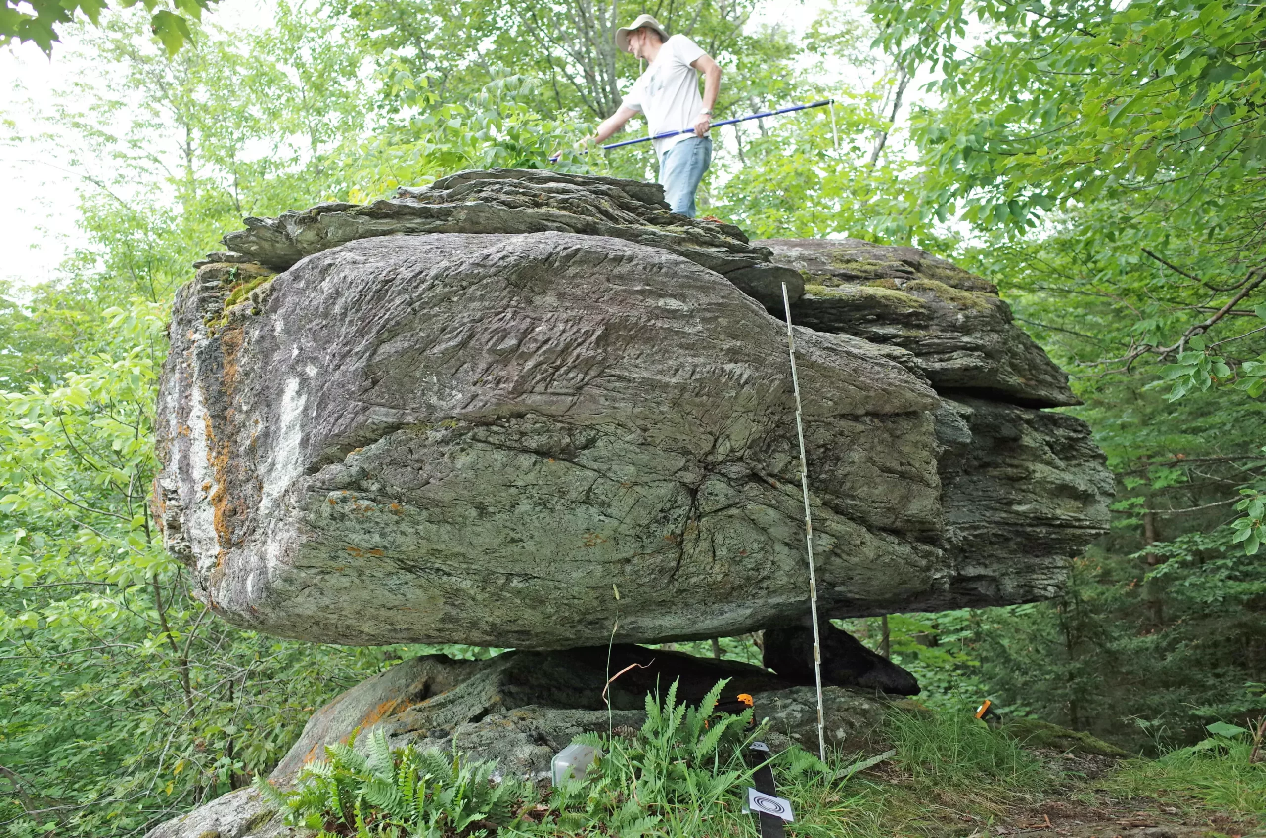
In the enigmatic landscapes of northern New York and Vermont, five unique boulders balance delicately on rock pedestals, providing crucial insights into the region’s seismic history. These precariously balanced rocks (PBRs), shaped by glacial activity, serve as natural seismometers, revealing the intensity of shaking necessary to dislodge them. The innovative study conducted by seismologists Devin McPhillips and Thomas Pratt, as noted in the Bulletin of the Seismological Society of America, pushes the boundaries of how we can assess earthquake hazards in areas where traditional data may be sparse.
This research is monumental not merely for its findings but for its novel methodology. Historically, studies focusing on seismic mechanics and hazard assessment have leaned heavily on softer data collected from fault lines or liquefaction events in more seismically active zones such as California. However, McPhillips and Pratt have ventured into underexplored territory, employing the PBR approach to add depth and detail to the earthquake risk profiles in the eastern United States—a region often overshadowed by its western counterparts despite possessing its own seismic hazards.
The fragility of the PBRs serves as a barometer for seismic activity. By determining how much shaking it would take to topple these boulders, McPhillips and Pratt can infer the maximum expected intensity of future earthquakes in the region. This math is both strategic and essential: knowing the peak ground accelerations needed to destabilize these rocks not only aids in understanding historical earthquake intensity but also helps inform future preparedness and risk mitigation efforts.
The assessment revealed that while four of the five boulders aligned with the U.S. Geological Survey’s 2023 predictions for seismic activity, one notable boulder indicated a potential decrease in risk. Interestingly, this suggested the exclusion of significant earthquake sources in large regions of the Adirondack Mountains and the southern Lake Champlain valley. Such nuanced insights contribute significantly to our understanding of regional seismic hazards, emphasizing the importance of local geological features in redefining risk assessments.
To add another layer of sophistication, the team created detailed maps that showcase the minimum distances from which a sizable earthquake could strike without dislodging the PBRs. This geographical mapping is invaluable, as it assists in highlighting the locations of active faults and historical seismicity that previously might have gone uncharted or misinterpreted. The use of lidar and field observations enabled the researchers to paint a broad picture of the seismic landscape and pinpoint where incoming threats might arise.
Historical seismic data provides context to their findings: northern New York has a documented history of earthquakes, including notable occurrences such as the 1944 Massena quake and the 1983 Newcomb event. Understanding the region’s geological past is crucial; it forms the backbone of their analyses. As such, this study presents a more robust framework for seismic hazard assessment that combines geologic, historical, and novel measurement techniques.
A fascinating aspect of the research highlights the impact of local knowledge in geology. McPhillips and Pratt relied significantly on input from hikers and enthusiasts familiar with the secluded landscapes, facilitating the identification of PBRs which might otherwise elude a broader survey. The collaboration with local guides and climbers proved essential in overcoming the dense forestry that masks these geological treasures. This intersection of community knowledge with scientific inquiry illustrates the power of local engagement in scientific research.
Moreover, it emphasizes a realization within geoscience: often, the most profound findings arise from the integration of diverse types of knowledge and expertise. By actively seeking collaboration, researchers can uncover valuable insights that traditional methods alone might miss.
As McPhillips expressed optimism about the prospects of uncovering additional PBRs, it signals a burgeoning field of study anxious to grow. With their current findings bolstering established models of risk and hazard in the region, there is a tangible momentum building for continued investigation. The repercussions of this work reach far beyond academia—understanding where and how seismic risks manifest can play a crucial role in preparedness and resilience in vulnerable areas.
The innovative research surrounding precariously balanced boulders in northern New York and Vermont reinforces the significance of localized, detailed seismic studies. As the quest for greater seismic understanding continues, it invites researchers to widen their lens and explore new terrains contributing to the ongoing puzzle of earthquake hazards in the northeastern U.S.

