Accurate positioning in urban areas has long been a complicated endeavor. The obsolescence of Global Navigation Satellite Systems (GNSS) based Real-Time Kinematic (RTK) technologies in cities is largely due to obstruction and signal interference from dense architectures. These factors make achieving the high precision often required for critical applications challenging. Traditional methods have attempted to overcome these hurdles with supplementary technologies like Wi-Fi and Bluetooth; however, they fall short in offering the needed consistency in signal quality and accuracy.
Recent advancements bring 5G technology into the spotlight as a potential savior for urban positioning woes. With its enhanced speed, larger bandwidth capacity, and robust network density, 5G presents a promising alternative to tackle the endemic signal integrity issues experienced by current solutions. Researchers at Tsinghua University are pioneering a new direction in this realm with their innovative approach: a 5G-assisted BeiDou Navigation Satellite System (BDS) RTK positioning mechanism. Published on August 26, 2024, in the journal Satellite Navigation, their work showcases the vital role that 5G can play in modern positioning technologies.
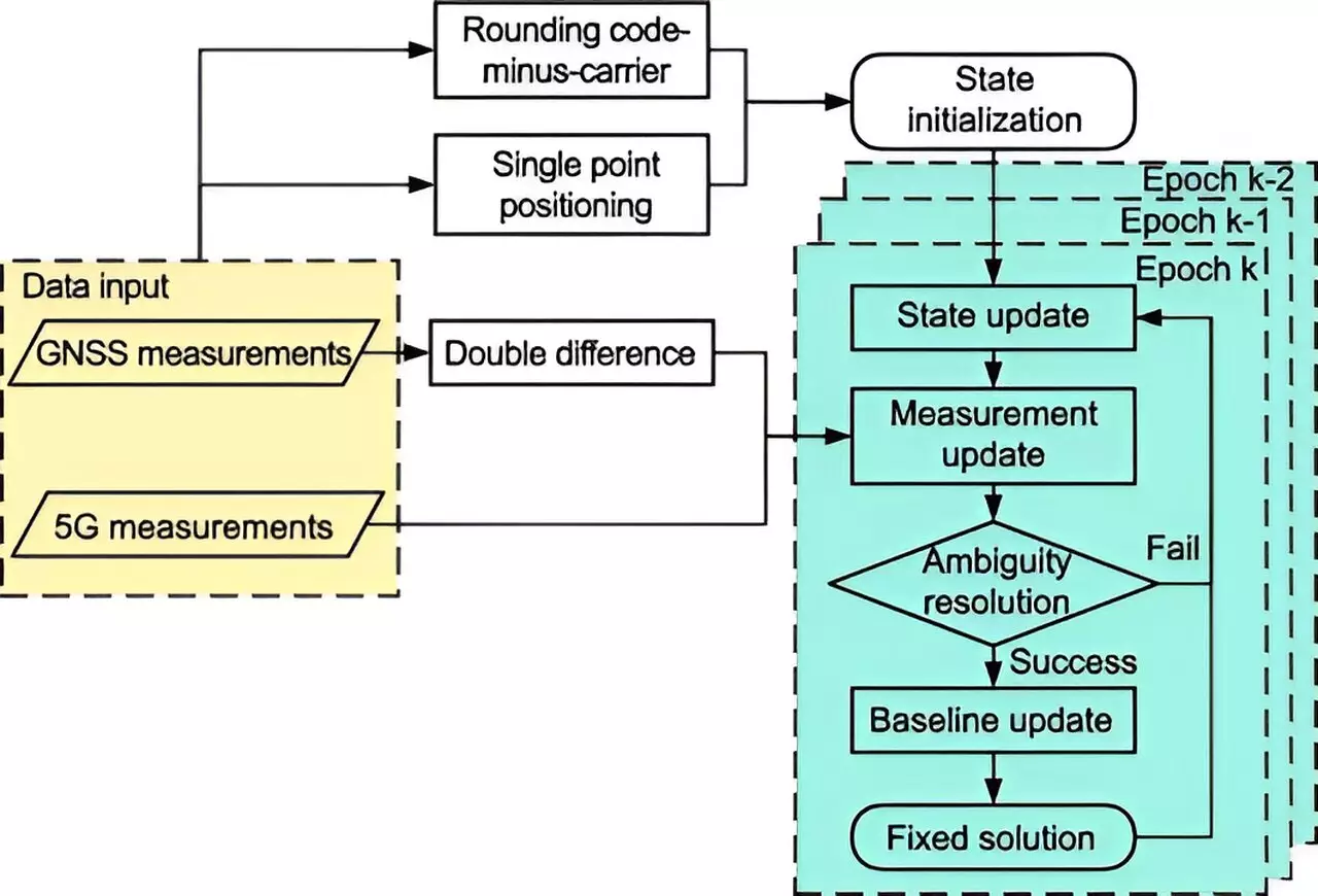
The new system employs an extended Kalman filter alongside sophisticated ambiguity resolution methodologies, effectively combining 5G data with traditional satellite signals. The results of this amalgamation have been profoundly positive. The research indicates that the integration of 5G has markedly enhanced the performance of positioning accuracy in urban environments. Findings revealed that spatial errors fell by a striking 48% in the full ambiguity resolution (FAR) mode, while partial ambiguity resolution (PAR) mode saw reductions of up to 18.8%. Furthermore, the improvements in fixing rates—from 11.11% to 13.93% in FAR mode, and from 32.58% to 44.43% in PAR mode—illustrate how 5G can ameliorate the longstanding issues of urban signal blockage.
Beyond the academic implications of this research, the practical applications of a 5G-enhanced BDS RTK positioning system are vast. Dr. Tengfei Wang, one of the lead researchers, emphasized that this innovative integration serves not only to enhance signal quality and satellite visibility but also paves the way for better urban navigation systems. It holds promise for vital sectors like autonomous vehicle operation, ensuring public safety, and propelling initiatives aimed at developing smart cities.
Currently, 5G networks are being deployed at an unprecedented rate, creating a structure that can support this scalable and adaptive positioning solution. Moving forward, additional research will be essential to test the capabilities of this integrated system in various practical scenarios, aiming to refine its performance further and solidify its reliability in complex urban landscapes.
The work of Tsinghua University marks a significant milestone in the evolution of positioning systems in urban areas, demonstrating how 5G technology can harmonize with traditional GNSS frameworks for enhanced accuracy and reliability. As cities continue to grow and evolve, employing innovative technologies like this could very well redefine how we navigate and interact with urban spaces, fostering a future wherein precision is not just an ideal but a reality.