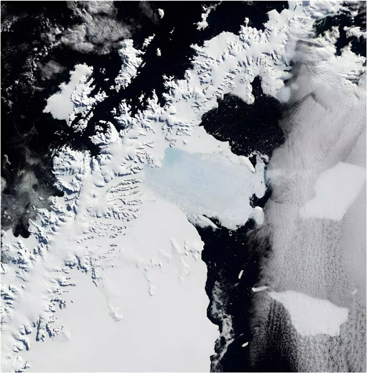
In March 2002, we witnessed an alarming environmental event: the Larsen B Ice Shelf met its catastrophic end, disintegrating over the course of just a week. This massive area, approximately one-sixth the size of Tasmania, acted as a barrier preventing the rapid flow of five glaciers into the sea. What might seem like a distant phenomenon is part of a much larger puzzle—one that holds the potential to impact global sea levels and, consequently, coastal communities around the world. As the climate continues to warm, understanding the consequences of this breakup is not just an academic exercise; it is a pressing necessity in light of rising sea levels that threaten habitats and human lives alike.
Using Historical Imagery to Dart into the Past
Amidst the urgency of addressing climate change lies a critical gap in our understanding of Antarctica’s ice dynamics prior to the Larsen B collapse. Until now, observational data was scarce. However, researchers recently employed nearly 1,000 film photographs from the 1960s, archived meticulously by the U.S. Navy, to reconstruct the state of the five glaciers that flowed into the ice shelf several decades before their disintegration. These historical images, combined with cutting-edge techniques like photogrammetry, have unveiled a treasure trove of information on the glaciers’ evolutions and foreshadowed the alarming consequences after the ice shelf’s collapse.
This endeavor is not merely about curiosity; it paves the way for understanding the glaciers’ contributions to sea-level rise—a harrowing reality exacerbated by climate change. Surprisingly, these historical images, which are freely accessible for science enthusiasts and experts alike, serve as a bridge to connect past knowledge with future predictions.
Interconnected Systems: Ice Shelves and Glaciers
Ice shelves are not mere inert formations; they act as sentinels, holding back the flow of glaciers that would otherwise surge into the ocean. To comprehend the repercussions of the Larsen B collapse, we must recognize the chain reaction it initiated. Following the collapse, the five glaciers that had relied upon the support of the ice shelf lost an astounding 35 billion tons of land-based ice. This drastic shift may seem small—equating to just 0.1 mm of global sea-level rise—but it carries weighty implications. Such incremental losses accumulate over time, raising sea levels steadily and inevitably.
Moreover, each glacier contributes in its own right, and examining these varied contributions will be invaluable as we try to predict future shifts. The unfortunate reality is that many areas in Antarctica are too remote for regular, direct monitoring, which makes the historical archive a goldmine for researchers seeking to establish patterns and trends over an extended period.
The Technological Marvel of Photogrammetry
What sets this research apart is the innovative approach of photogrammetry employed to transform the glossy, historical film photographs into accurate 3D models of the glaciers. This technique allows scientists to analyze the glacier surfaces like never before, revealing vital information on their structure and movement. By utilizing matching points across hundreds of overlapping images, researchers can construct geographical representations that rival those created by modern satellites, despite the considerable hurdles posed by cloud cover and the inaccessibility of many regions in Antarctica.
The excitement over this methodological leap is palpable, as it not only sheds light on past conditions but also provides essential data for modeling future changes. This technology holds the key to rigorous scientific inquiry into how Antarctic glaciers may respond to climbing temperatures and shifting weather patterns.
The Need for Urgent Climate Advocacy
As climate change accelerates, the fate of ice shelves like Larsen B becomes increasingly precarious. The alarming findings from studies relying on historical imagery underscore the pressing need for robust climate advocacy and action. If we are to mitigate the effects of rising sea levels—scope, scale, and intensity—we must harness the potential of resources like the historical image archive. Looking ahead, these precious materials can serve broader purposes, such as assessing impacts on ecosystems, like penguin colonies, or examining changes in coastlines and vegetation expansion.
However, leveraging these invaluable resources requires both commitment and funding. The urgency of expanding the knowledge base through historical data collection cannot be overstated, particularly as we continue to grapple with the ever-ticking clock of climate change. Each glacier that loses ice echoes a warning that reverberates far beyond the icy landscapes of Antarctica, urging humanity to recognize our interconnectedness with the planet.
With determination and focus, we must tap into the historical knowledge and modern technology at our disposal to address the global imperative of climate variability. The challenge may be immense, but the opportunity for meaningful change and understanding is equally significant.